Featuring
- Frederick Douglass in Britain and Ireland19th century transatlantic abolitionism mapped by Hannah Murray, 2020.
- Mapping the 1919 Chicago Race Riot, University of ChicagoOn July 27, 1919, Eugene Williams, a Black teenager, crossed an imaginary color line in the water at the 29th Street Beach. White residents threw stones at him to prevent him coming ashore, which resulted in the teenager drowning. His death sparked the largest race riots in Chicago history, a week that caused 38 deaths and hundreds of injuries. The map shows where the deaths and injuries occurred, as well as original newspaper articles and photos from the riots.
- Mapping the Blues: A Cultural Geography of the Black Metropolis in the 1960sDigital Chicago, Lake Forest College, using the photographic archive of Raeburn Flerlage at the Chicago History Museum.
- Opportunity AtlasUses census data and income tax returns to measure Americans' economic mobility over time in any given part of the country, by Harvard University team of researchers and policy analysts.
- Racial Disparities in Police Arrests MapBeth Redbird (NU IPR sociologist) measured racial disparities in data from 1999–2015 (Sept 2020)
- Redlining Louisville: Racial Capitalism and Real EstateBy an urban planning graduate student at the University of Louisville.
- Southern Poverty Law Center’s Hate Map940 hate groups across the U.S. (2019)


Africa Maps from Herskovits Library

16th - Earth 20th Century Maps of Africa
Digital copies of 113 antique maps and accompanying text dating from the mid 16th to early 20th centuries. Maps are authentic and collected by the Melville J. Herskovits Library of African Studies (Africana Library) at Northwestern University. The cartouche above is from a beautiful 1635 map by Bleau.
More African Maps
Map History: Africa: A collection of links to online & historic Africa maps.
Perry-Castañeda Library Map Collection - Africa Maps: Africa maps available on the web and good sources for contemporary, mid-scale topographic maps produced by US government.
Harvard - AfricaMap
AfricaMap lets researchers discover and explore various geographic information on one map. Various data and scanned historic & topographic maps ("Map Layers" > "Base Mapping") are available.
The Trans-Atlantic Slave Trade Database
This database (here is the actual database download site) compliments a new atlas, Atlas of The Transatlantic Slave Trade, You can also see the flows of the slave trade in the AfricaMap site above (see under "Map Layers" > "Economics" category.)
GEOSPATIAL DATA REPORT : Finding & Using GIS Data - Africa
My GIS data directory for people who need current geospatial/GIS data for Africa. Or, please just ask me if you want to locate data!
Maps Online
- African American Trail Project, Tufts University, Medford, MAMapping historic sites across the state of Massachusetts.
- Interactive Map of Contraband Camps [American Civil War]Prof. Abigail Cooper, Brandeis University.
- Lynching in the United States: 1883-1941Interactive map by David Rigby and Charles Sequin, Penn State.
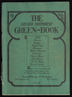
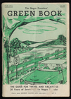
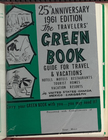
- Map a Trip (The Green Book)Using addresses extracted from The Negro Motorist Green Book: 1947.
- Map of White Supremacy mob violenceMonroe Work's (1866–1945) documentation of lynching in the U.S.
- Mapping Inequality: Redlining in New Deal AmericaMaps produced 1935-1940 by the Home Owners' Loan Corporation.
- Mapping PrejudiceHidden histories of race and privilege in Minneapolis, University of Minnesota.
- Mapping Racial Violence in AmericaRacial Violence Archive, by Dr. Geoff Ward, Washington University in Saint Louis.
- Mapping Segregation in Washington DC; By Prologue DCLot-by-lot documentation of racial deed covenants over several decades.
- Mapping the Freedman’s BureauBy genealogists Toni Carrier & Angela Walton-Raji.
- Mapping the Unmapped Black Settlements of TexasThe Texas Freedom Colonies Project, Texas A&M University
- Million Dollar Hoods Project, UCLALos Angeles Sheriff’s & Police Dept. incarceration expenditures, 2010-2015.
- Opportunity AtlasSocial mobility data for people born 1978-1983.
- Persuasive Maps: PJ Mode Collection (subject: slavery/race)Opinions rather than geographic info, Cornell U. Library Digital Collections.
- Renewing Inequality: Family Displacements through Urban Renewal, 1950-1966University of Richmond's Digital Scholarship Lab project.
- SPLC Interactive Hate MapSouthern Poverty Law Center's annual count and mapping of U.S. hate groups.
- U.S. Civil Rights TrailLandmarks where segregation was challenged in 1950s &1960s.
- Underground Railroad Map: Network to FreedomNational Park Service, U.S. Department of the Interior
Mapping resources & tools
- ARCGIS Living Atlas of the WorldMaps, apps, and data layers contributed by Esri GIS mapping software partners and users.
- Big Ten Academic Alliance GeoportalThe Geoportal aggregates publicly-available geospatial resources, which are curated by librarians and specialists at twelve universities in the Big Ten Academic Alliance. These resources include GIS datasets, digitized historical maps, and web services, and each item is also accompanied by descriptive metadata along with links to download or view the full resource. They are easily searchable by both text and map and they can also be browsed by place, data type, and subject.
- Digital Sanborn Maps for IllinoisFire insurance maps for most cities and towns in Illinois 1867-1970. Maps contain building footprint, construction materials, building use, and location of windows and doors, as well as street names, factory and business owner names, street and sidewalk widths, property boundaries, and house and block numbers.
- Musical Geography"Mapping place and movement throughout music history." includes "American Southern Folk Song Collecting," "Mapping Black Gospel Music," "Mapping Slave Songs of the United States,” "Mapping the Tours of the Fisk Jubilee Singers from 1871 to 1881, "Travels of Josephine Baker and Sidney Bechet,"and, "Jazz Venues."
- National Historical Geographic Information SystemNHGIS provides population, housing, agricultural, and economic data, along with GIS-compatible boundary files, for geographic units in the United States from 1790 to the present.
- Neighborhood AtlasResource of the Area Deprivation Index (ADI) of neighborhoods across the U.S. ADI is a numerical measure of public health that was developed by the Health Resources and Service Administration. Created by the Applied Population Lab at UW-Madison, visitors can view ADI data by census block. ADI figures are based on the 2013 American Community Survey Five Year Estimates.
- Sanborn Maps Geo EditionSanborn Mapsprovides geo-referenced digital access to thousands of large-scale maps of 12 major metropolitan areas searchable by address and GPS coordinates.